
4 Safe Solutions LLC
We are a specialized provider of advanced 3D scanning, structural processing, and water system mapping services, delivering high-precision digital models and geospatial data for infrastructure, industrial, and urban environments. Our expertise extends to deep sewer detection and non-destructive technology (NDT) applications, enabling clients to assess, maintain, and optimize critical assets without causing damage or service disruption.
Using state-of-the-art LiDAR, high-definition laser scanners, ground-penetrating radar (GPR), and hydrographic mapping tools, our team captures and processes detailed structural and subsurface information. We provide accurate point clouds, BIM integrations, and GIS-ready datasets for planning, engineering, and emergency response.
- Our capabilities include:
• 3D Scanning & Structural Processing: High-resolution scans for buildings, bridges, tunnels, and complex facilities, delivering precise as-built models for engineering, retrofitting, and safety assessments.
• Water System Mapping: Complete mapping of potable water networks, treatment plants, and distribution systems for monitoring, optimization, and asset management.
• Deep Sewer Detection: Locating and assessing sewer lines and drainage systems up to 25 meters deep with dual-frequency GPR and advanced subsurface imaging.
• Non-Destructive Technology: Inspection and diagnostics without excavation, demolition, or structural compromise, reducing downtime and operational risks.
With a multidisciplinary team of engineers, geophysicists, and GIS specialists, 4 Safe Solutions delivers accurate, actionable data that supports infrastructure resilience, regulatory compliance, and strategic decision-making.
Contact
WHY GO DIGITAL ?
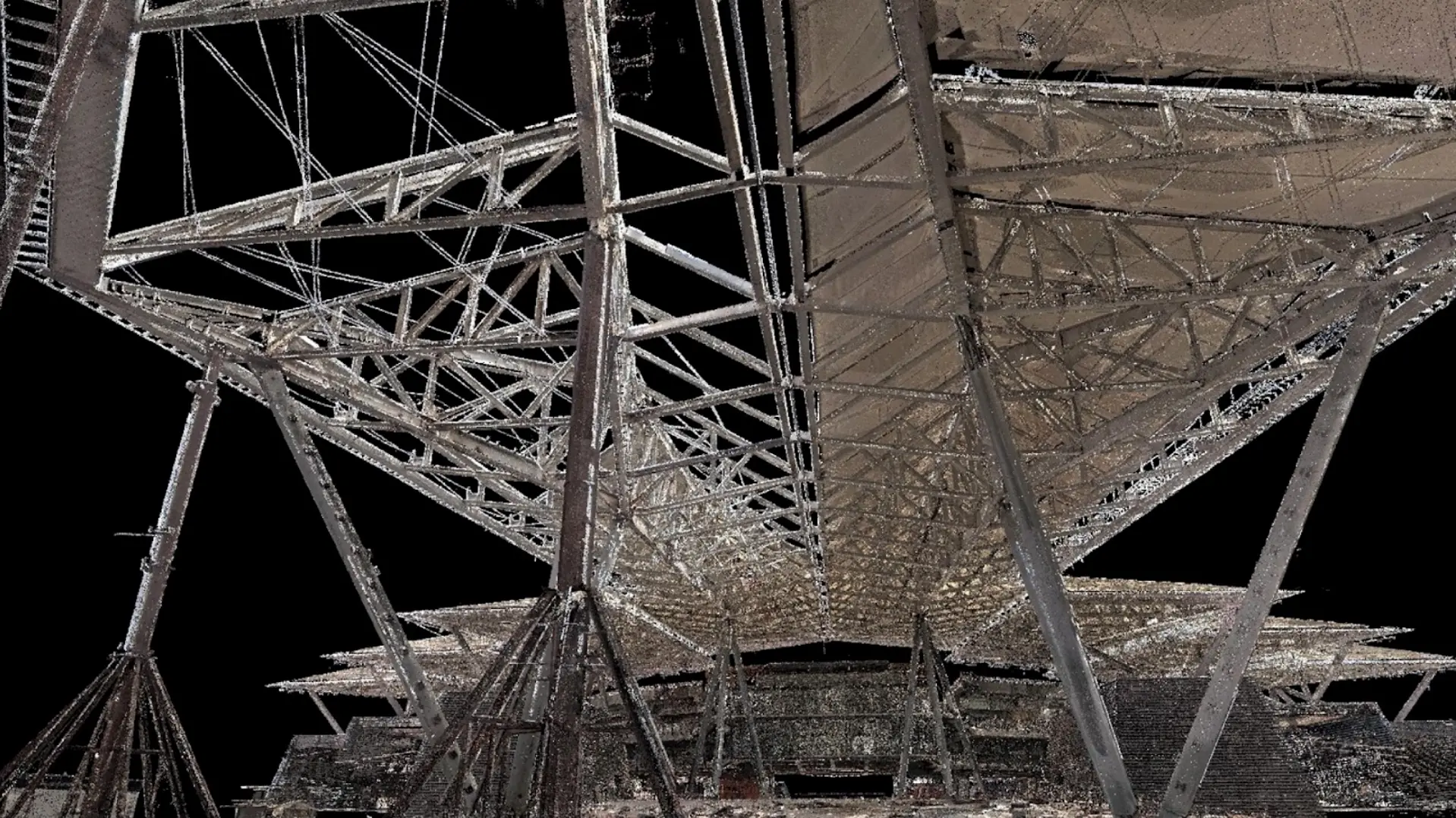
Building scan with cloud of points systems is a powerful technology used for construction structure safety assessment. It involves capturing a detailed 3D point cloud of a building using laser scanning or photogrammetry techniques.
With this point cloud data, construction professionals can perform various safety
assessments to ensure the structural integrity of buildings.
Advanced Reality Capture Services
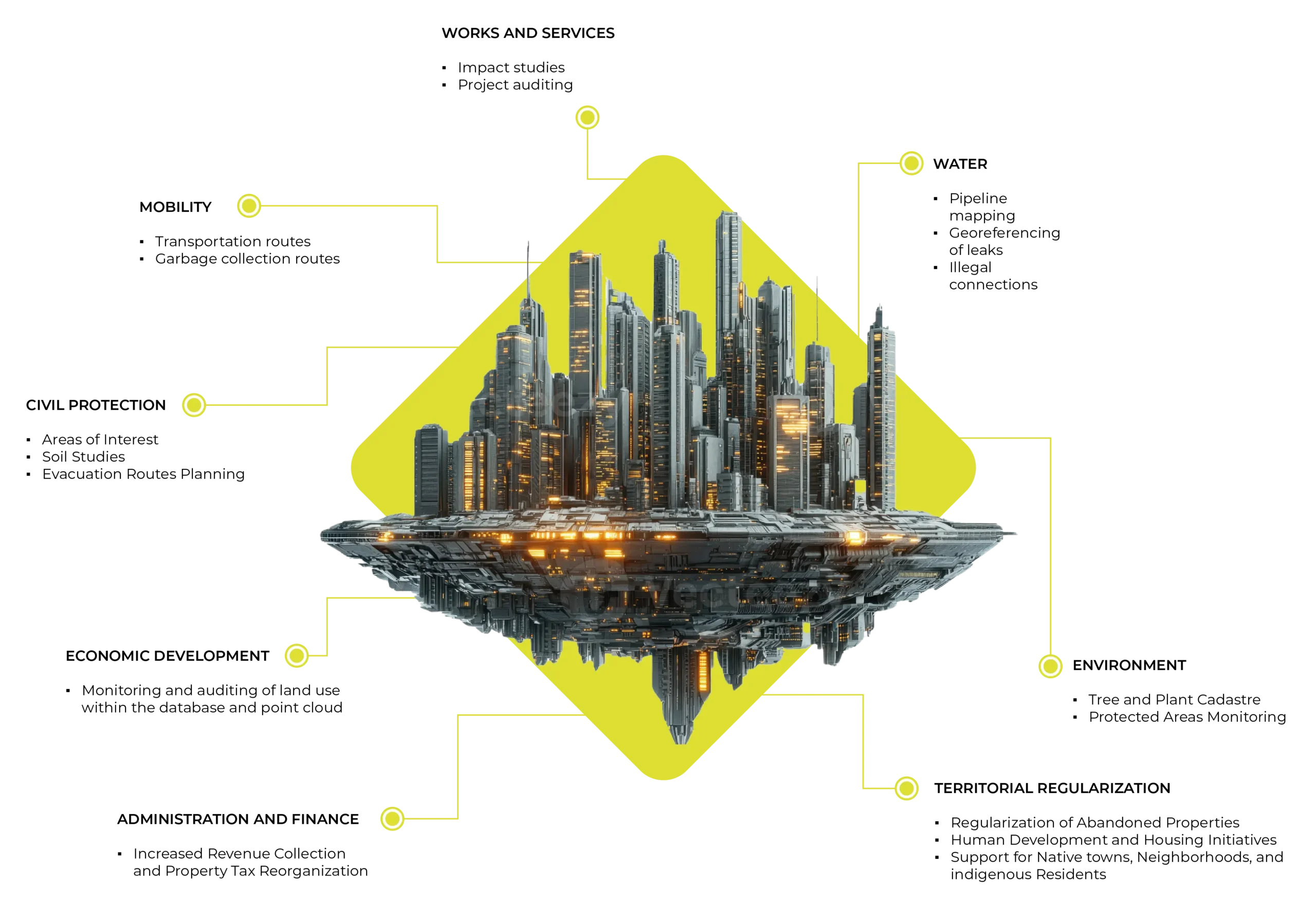
Georeferenced Utility Mapping & Comprehensive Digitalization of Public Infrastructure.
DIGITAL TRANSFORMATION IS CHANGING THE WAY CITIES ARE MANAGED AND OPERATE
- It improves the efficiency of public services.
- It makes cities more efficient, safer, and have a more sustainable growth .
- It improves the way public services and city managers operate and make decisions .
- It helps to study, plan and efficiently developed and expand new areas and up date, mapping and maintain sewer pipelines and the safety of buildings detecting non visible cracks, spills or leaking .
STRUCTURE SCANNING
Engineers can analyze the point cloud data to assess the structural components of the building, such as beams, columns, and load-bearing walls.
This analysis helps identify any potential weaknesses or structural issues that may
compromise the safety of the building.
Street and buildings structure digitazing is a specific application of reality capture that focuses on capturing the detailed geometry and characteristics of streets and buildings. This process allows for the creation of highly accurate digital models that can
be used for a variety of purposes, including urban planning, architectural design, virtual reality experiences, and historical preservation.
By digitally capturing street and building structures, we can create virtual replicas that can be explored and analyzed in ways that would be impossible in the physical world. This technology has the potential to revolutionize industries such as architecture, construction, and urban development by providing accurate and detailed representations of the existing environment.
SAFETY INSPECTIONS
By creating detailed 3D models or point clouds of the street pipelines, reality capture enables better visualization and documentation of the infrastructure. This can be particularly useful in coastal cities or humid places, where corrosion and erosion are common concerns. The captured data can be used to monitor the condition of the pipelines over time and identify areas that require attention.
RAILROADS, METRO RAILS, SUB-WAY and TRAIN mapping and assessment of conditions . REALITY CAPTURE allows to monitor every part of the systems and also ROADS and AVENUES efficiency for emergencies .
The EXPERIENCE and CREATIVITY of our Team is always leading us to keep INNOVATING and working with private and government entities all over the world.
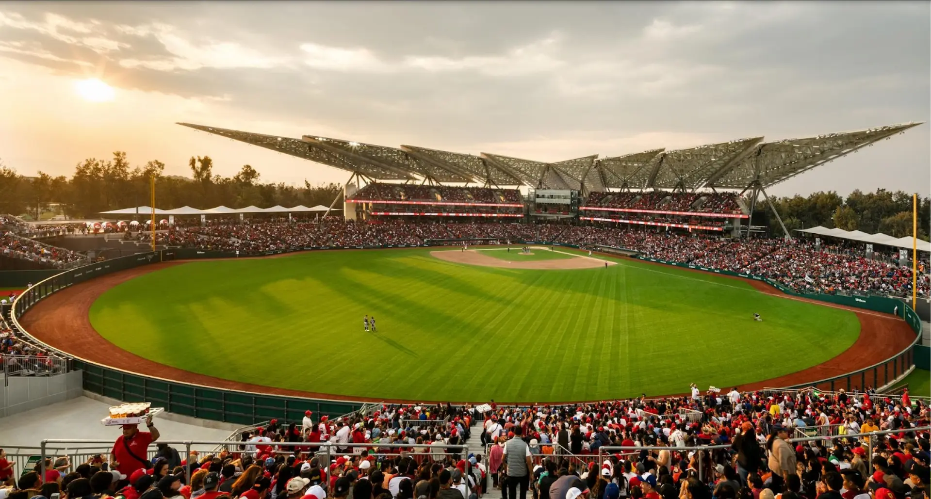
Our team scanned more than 350 smart buildings, different constructions, bridges, stadiums, etc…
MUCH MORE THAN ANY OTHER COMPANY in the industry .
Estadio corregidora
Scale simultaion program using the cloud of points
Estasio Harp
Estadio Finsus
Contact